The following is a quote from this site. https://gardenhistorygirl.blogspot.com/2011/04/garden-history-images-of-week-mexican.html
“These images are so beautiful that they actually make me feel the pangs of nostalgia–for a Mexico I never saw and never will see. Circa 1762, they are the work of Father Ignacio Tirsch, Jesuit missionary to the Baja peninsula, who over the five years of his sojourn there created a portfolio of forty-eight drawings rich in garden history; recording both productive and decorative landscapes, as well as native flora. The entire volume–architecture, costumes, flora and fauna–is a treasure of the Czech National Library, online at manuscriptorium (click on ‘facsimile’ to see the images).”
San Jose del Cabo, by Father Ingacio Tirsch, Circa 1762
Antigua California: Mission and Colony on
the Peninsular Frontier, 1697-1768
by Harry W. Crosby
(University of Arizona Southwest Center Book)
Hardcover – May 1, 1994
The photo on the cover is a watercolor facsimile of the original art, by Joanne Haskell Crosby, depicting San Jose del Cabo, based on the original drawings of Padre Ignacio Tirsch.
First published in 1994 and now available again, this Spanish Borderlands classic recounts Jesuit colonization of the Old California, the peninsula now known as Baja California. Jesuit missionaries founded their first settlement in 1697 and unintentionally created a Hispanic society that outlived the missions and their Indian converts. The author brings to light Jesuit missionization and culture, European-Indian contacts, mission and presidio operations, family social life, the unique peninsular economy, and the Jesuit expulsion.
The following are quotes from customer comments on Amazon.com
“For a scholar, the book is eminently useful: full of maps, chronological tables of people and places, explanations of systems and bureaucracies. For the history buff, it is a dream of readability and detail.”
“A chemistry teacher turned archeologist, anthropologist and historical researcher, Crosby’s book is without question a serious scholarly work but reads as easily as a novel. ”
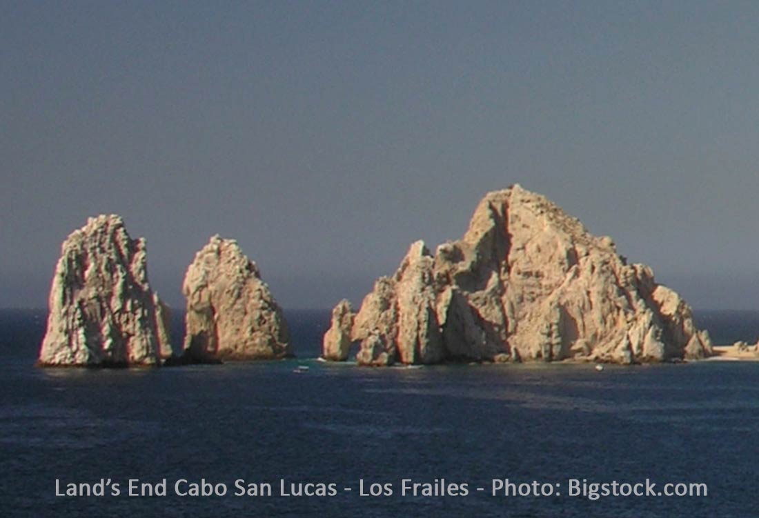
Below are various comments about the popular Cabo San Lucas landmark at Land’s End call Los Frailes or (The Friars, or Monks).
El Arco, the great arch itself, is also the boundary marker non pareil. It divides land from sea–it is the last stretch of uninterrupted land reaching down from Alaska to the southern tip of the 800 mile long Baja California peninsula–sea from sky, and the Sea of Cortés from the Pacific Ocean. Beyond it is the passage of water that weaves in between what Steinbeck once called the Friars, the large rocky sentinels that guard the bay. The largest of the three is called Cerro Blanco (white hill) by local fishermen, and is in effect Land’s End, although that designation is given to the entire promontory. https://www.loscabosguide.com/blog/2015/08/a-brief-history-of-los-cabos-30-million-years-at-lands-end/
“Known popularly as Los Frailes (The Friars), these rock islets look like hooded monks and are known to be a favorite hub of sea lions. Other rock formations near Land’s End in Cabo include Roca Pelicanos (Pelican Rock), a smaller rocky outcrop located off the northeast side of the cape. ”
Read more: https://www.destination360.com/north-america/mexico/cabo-san-lucas/el-arco
Los Frailes (the brothers) rock formations, Cabo San Lucas – Photo Bigstock.com – 91768016
There are several text references and a to the Los Frailes rock formations as well as a legend on the San Lucas map in Walt Perterson’s 1987 “The Baja Adverture Book”. The photo above is captioned “Cabo San Lucas and Los Frailes”.
———
Editor’s note: There are conflicting comments about the correct name. We are trying to clarify this information and will post an update when available.
Left: This Cliff Cross map from his 1970 Baja California Mexico Guide shows what the Los Cabos region looked like in the 1970’s. RIght: This 2013 Overview map hows the Los Cabos Region today.