John G. North c. 1910

The floating  tuna cannery off Cabo San Lucas prior to 1919.  The image below  is a copy of the photograph hanging on the wall at Latitude 22 The Roadhouse Cabo – www.latno2baddays.com/

three-master-john-g-north-c1910-latitude-22-3

The Caption reads: Peaceful setting—the three-master JOHN G. NORTH waits at anchorage. She burned while serving as a floating tuna cannery off Cape San Lucas, Mexico May 14, 1919 after years of sailing coastwise and to the South Pacific, carrying for the most part lumber and copra.

Photo of the John G. North and float on display at Latitude 22 The Roadhouse Cabo.


Latitude 22 The Road House Cabo •  Original Home of "No Bad Days". Photo taken May 2004  © Joseph A. Tyson • OldCabo.com
Take a few minutes to visit Mike at Latitude 22 The Roadhouse Cabo. The history  displayed on the walls is just amazing. His knowledge of the past is like a local encyclopedia. The photo on the right was taken in 2004.  Thanks, Mike.

Cabo Falso: The Lighthouse at the End of the Earth

Cabo Falso:  El Faro del Fin de la Tierra ( The Lighthouse at the End of the Earth)

Domingo Saiza Castro Presenta:  Historia de Baja California. https://faroviejo.angelfire.com/

A history of Baja California Sur presented by  Domingo Saiza Castro.

This site is in Spanish but has some good information and very nice old images.

Cuando desde la plataforma arenosa del faro de Cabo Falso he visto su luminoso parpadeo perderse en la infinita superficie del mar, he pensado que sus haces de luz no son una señal de alerta, sino de acogida; no de temor, sino de esperanza. Creo que son como un signo que se enciende por las noches para avisar a todos los puntos de la rosa de los vientos; que hacia el norte, desde la tierra perfumada hasta los bastiones de la patria, a todo lo largo de un cuerpo de desierto, hay un otro México de bellezas, de promesas y de futuro” – Epilogo del libro “El otro México” de Fernando Jordán

Source:  https://faroviejo.angelfire.com/

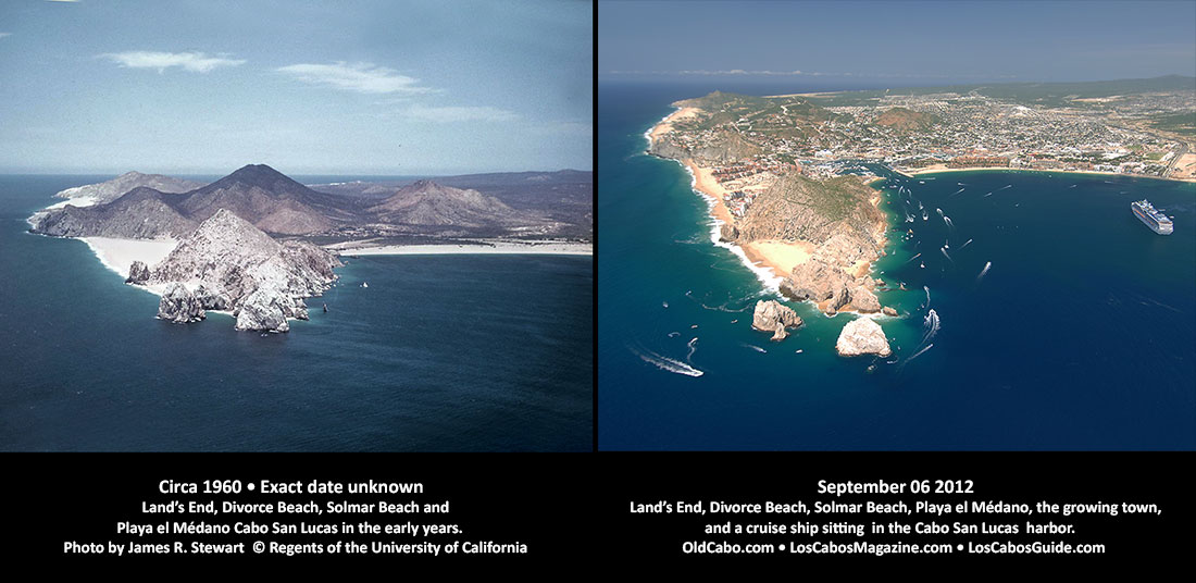
Aerial View Land’s End Then and Now

Left: Circa 1960 • Exact date unknown Land’s End, Divorce Beach, Solmar Beach andPlaya el Médano Cabo San Lucas in the early years. Photo by James R. Stewart © Regents of the University of California Right: September 06 2012 Land’s End, Divorce Beach, Solmar Beach, Playa el Médano, the growing town, and a cruise ship sitting in the Cabo San Lucas harbor. OldCabo.com • LosCabosMagazine.com • LosCabosGuide.com
Left: Circa 1960 • Exact date unknown. Land’s End, Divorce Beach, Solmar Beach andPlaya el Médano Cabo San Lucas in the early years. Photo by James R. Stewart © Regents of the University of California
Right: September 06 2012. Land’s End, Divorce Beach, Solmar Beach, Playa el Médano, the growing town, and a cruise ship sitting in the Cabo San Lucas harbor.
OldCabo.com • LosCabosMagazine.com • LosCabosGuide.com

Below is an older version of similar images.

aerial-cabo-beach-bay-2222-2012-set
Aerial view of Land’s End , Harbor and Playa el Médano (Medano Beach) Cabo San Lucas. Image on Left: date and source unknown – estimated c1950s. Image on right: September 06, 2012 © Joseph A. Tyson OldCabo.com • LosCabosMagazine.com • LosCabosGuide.com

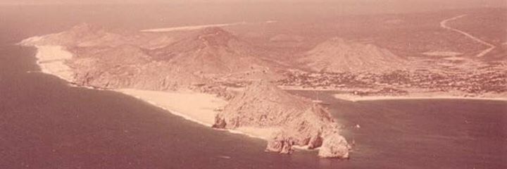
Does anyone have any information about the image on the left above?  This aerial view of Land’s End at Cabo San Lucas was found on the internet but I have not been able to exactly identify the date it was taken,  the source of the image or the owner.  Any information would be appreciated.

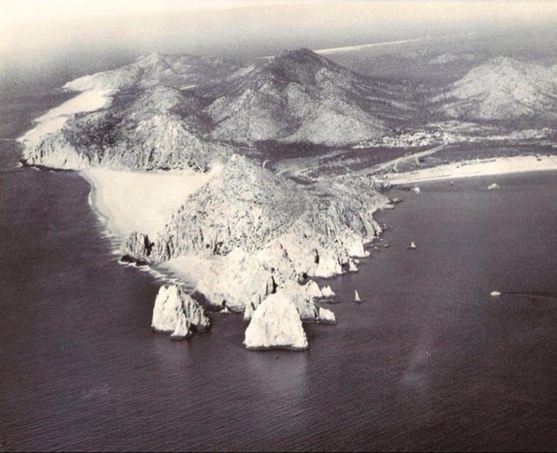
aerial-photo-lands-end-pre-hotels-c1950s-2

This is another version of the Land’s End  image from the internet. This shows more of Medano Beach.  Exact date taken and  the source of the image or the owner is unknown.

Aerial View of Cabo San Lucas c1970

Lands End Cabo aerial view c1970

Aerial views of Cabo San Lucas during the 1970.

lands-end-cabo-aerial-c1970
This aerial view of Land’s End at Cabo San Lucas was located on the internet but I have not been able to exactly identify the date it was taken, the source of the image or the owner.


Vista Aérea de Cabo San Lucas en la década de los 70s. Relatos Y Leyendas De Baja California Sur


Any comments are welcome.
Please send  an email to oldcabo@gmail.com